 |
| Mt Baldy (San Antonio) and West Baldy from the North |
The other day I climbed up a ridge I had only been on once before.
 |
| Looking down at North Fork Lytle Creek |
Back 17 years ago I decided to climb a mountain for my birthday. This despite the forecast of a storm. I was thinking that if conditions got too bad I would turn around and return without bagging the summit. Most of my friends and family know this story well so I won't recount here... though I may add it in the future. Long story short: I made it to the summit of Mount San Antonio (Mt Baldy). Then after a quick 15 minute stay walked off the north side in the near whiteout conditions. I thought I was walking off the south side. oops. I worked my way down the steep snowy slope expecting to cross the Manker Flat trail, but never found it. Instead I eventually reached a 2 meter drop off I could easily drop down but could not have come back up. Not knowing what was past that drop I opted to begin climbing back up the slope in the direction I thought would get me closer to the trail-head. Of course I still believed I was on the other side of the mountain. I worked my way to the summit of Dawson Peak and spent the night on the steep slope in an emergency bivy sack. The next day I worked my way down a long ridge to the wash below. Once I got to the wide wash I finally recognized that I was in Lytle Creek and not above Baldy Village. It was a rude awakening. 6 miles later I got to a house and asked to borrow the phone. A very long ordeal was over.
Ever since that long ago birthday I struggled to understand the mistakes I made, the route I took. It was a few years before I realized the cairn I kept to my left when walking off the summit was not what it seemed. That cairn had been repurposed into a windbreak. In the poor visibility what I mistook for the cairn was a windbreak next to the North Backbone trail.
My memories of the event and compressed, fragmented and a bit fuzzy. I was quite fatigued by exhaustion and stress when I reached the drop off and decided to climb back up. I found some game trails and saw trees cut by chain saws. Both convinced me I was heading the right way. When I reached the summit of Dawson, not realizing where I was, I saw human footprints before the snow covered them. I was following those thinking I was on the right track. Near the summit it was getting late in the day. The temperature had dropped. I decided I had to layer up. Pulling off my Gore-Tex and donning my heavy fleece I had real trouble zipping my jacked. My fingers were very numb and I was on the verge of panic. I realized I had waited too long to put on more layers and that if I couldn't zip my jacked my chances of survival were not good. I hiked until about 20:30 when it was far too dark to continue and after slipping I had snapped one of my trekking poles. That's when I found a small tree to curl up under the shiver the night away.
 |
| Mt Harwood and Mt San Antonio from Dawson ridgeline |
Visibility had been severely restricted the day I got lost, as well the day I hiked out. I was never clear where I was at any stage in this adventure.
A few years ago I hike the North Backbone trail. This took me to the summit of Dawson but nothing looked familiar. Not surprising as I probably didn't cross anywhere I went on my long ago birthday.
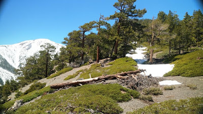
Back to the present: The COVID-19 pandemic has resulted in a number of trail closures. Since most of the areas I usually hike in are closed my hiking partner and I decided to go up Dawson from the North Fork of Lytle Creek. We didn't take the same route I hiked out 17 years ago. Instead we found a gully off the north slope with large patches on snow. It's so much easier to ascend steep snow in crampons than to bushwhack up a slope. Once we reached the upper ridge-line I continued to the summit. It's an unusually beautiful area. All the while I was thinking of the night I spent there and wondering what route I'd taken.
 Some of my observations: The ridge I hiked down was much longer and more daunting than I recall. The edge of that ridge is extremely dangerous with a crumbly cliff of dirt and rock that would result in a fatal fall. I had hiked down that ridge without food or water, beginning in the very dim light of predawn.
On our way back out the 4x4 road from the North Fork it occurred to me that I feel like a cat. More precisely, I feel like I burned through one of many lives that day and night 17 years ago. If this were someone else's story. And if they offered to take me on a trip to recreate the event, I'd scoff at them. Looking over the terrain I'd call them out and refuse to believe the story. So it goes.
 |
| The summit of Dawson Peak |


